It's time to tune in to channel 4.1 for the Moxie report of Sultan and Spencer Peaks.
We hiked approximately .5 miles up the Colorado Trail until we reached this small cairn.
Then in official Moxie style, we left the trail and started bushwacking up the ledge.
Candy was afraid she would get lost on the way down so she added rocks to all the small cairns.
Hiking up the "first" steep section
The trail kept getting steeper and we were only on the first section of the trail.
Barbara decided to take a break and catch her breath.
Candy looks back and sees Barbara resting and tells her to get back on the trail.
Tim, Angela and Penny wait for Jane Marie and Candy.
Barbara and Marianne coming up the trail. We started at Little Molas Lake to the right.
Our first view of Spencer Peak 13, 087'
Penny leads the way.
Marianne gets a shot of Spencer. I'm sure she is remembering her dad.
Moxie Man Tim and Angela Bouchard enjoying their electronic devices during our first snack stop. Penny looks on in disbelief.
Starting up towards Spencer.
Getting close to Spencer Saddle.
No one told us that we had to climb through a rock chute to reach Spencer and Sultan. Angela who is fearful of heights starts the climb.
Barbara looking up the chute.
Barbara on the trail with Engineer Mt miles away.
Heading up the side of Spencer peak.
Jane Marie radios Tim and Angela who are heading to Spencer Peak for lunch and to play on their phones. Barbara stops at this point. Penny, Jane, Marianne, Candy and myself head for Sultan Peak.
Crossing the narrow dangerous scree sloped bridge. Sultan lays ahead.
Marianne crossing the bridge.
Penny, Jane Marie, Candy and Marianne start up towards Sultan Peak.
We stop to look back at Spencer Peak. We are looking for Tim and Angela.
Can you see Tim and Angela on the top of Spencer?
Jane Marie and Marianne signal to Tim and Angela that everything is okay.
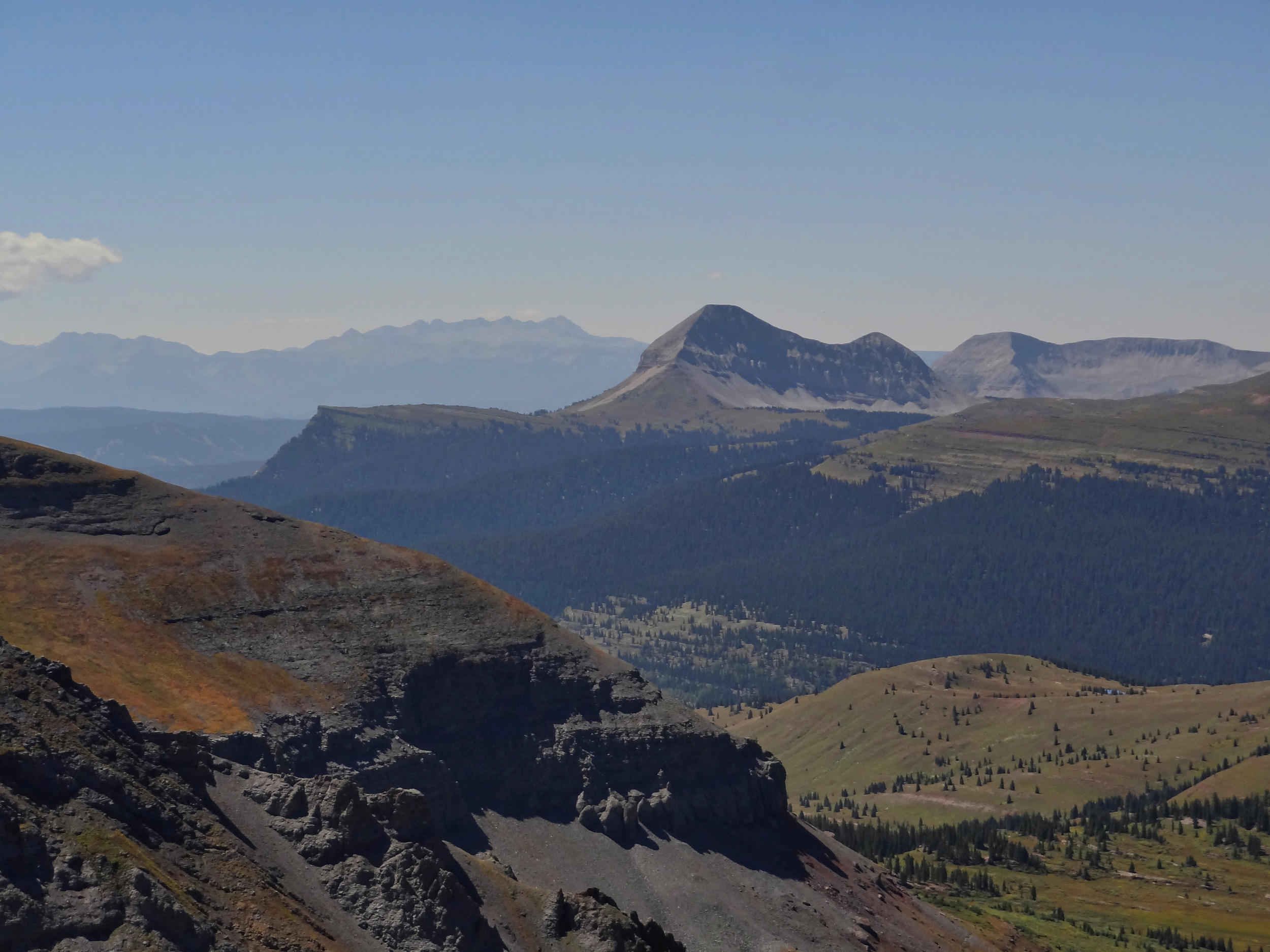
View towards Ice lakes Basin and surrounding Peaks
Engineer Mountain
Candy stops for a quick drink. She is disappointed to find out that there isn't a snack shack at the top.
Heading up Sultan.
The rock looked like a mountain Peak. I think I will name it: Moxie Peak.
It was a beautiful day. Sunny with not much wind.
Heading up the false summit. Jane Marie radios Tim and Angela that we are only 5 minutes from the top. We are excited to think we are so close.
But we were not 5 minutes from the top. We keep climbing.
Marianne nears the top of Sultan.
Silverton, Colorado from the summit of Sultan Peak.
Jane Marie and Candy radio Tim and Angela to let them know we made it to the summit.
Marianne signs the summit register.
Jane Marie signs in. Pink is the color of the day.
Candy signs in.
Penny signs in.
The proof that we made it to the summit of Sultan Peak, 13, 368
The Moxies digging for food!
Penny and Julie at the summit with Silverton below
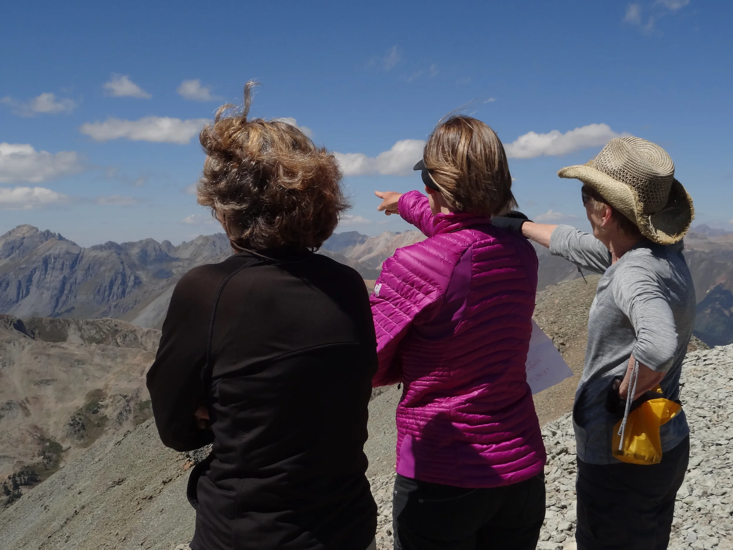
Jane Marie and Penny scouting out the area.
I finally finished taking pictures and sat down for lunch when Penny states "It's time to go" I put my chex mix in my pocket with hopes of eating it as I hiked down the trail.
The trail was too steep to eat and hike.
Ground Cover changing to its fall colors.
Sultan Peak
The "bridge" to Sultan. I can't believe we hiked that.
Moxies crossing the "bridge" back to Spencer Peak.
Expansive views
View of Molas Lake and the surrounding Peaks.
The trail going up to Spencer.
Candy looks up at the trail to Spencer Peak.
Penny with Sultan Peak in the background.
Jane Marie, Bella and Marianne going up the trail to Spencer Peak.
The Moxies make it to Spencer peak 13,087'
Surrounding peaks
Penny, Candy, Marianne sign into the summit register.
Jane Marie and Bella enjoy the views and a quick snack.
King Crown changing color
Heading down Sultan Peak.
Fall Color with Engineer in the background.
More Kings Crown on the way down from Spencer.
Views in every direction.
View from Spencer Saddle.
Penny heads down from Spencer Saddle.
Candy heads back down the trail. We received a text from Tim & Angela that they had to divert down a different trail due to the sheep dogs and sheep. Luckily, they were gone by the time we reached the meadow.
Heading back down towards our starting point at Little Molas Lake.
It was late afternoon when we returned to the trailhead. It was approximately 8.6 miles and and elevation gain of 3,208' to reach both summits. It was a long day but exciting hike.